
Charleston County Neighbors by Parcel
Public records around a block answer different questions. The county map identifies the land, the assessor identifies the assessed owner and parcel facts, and the deed index identifies parties to a recorded transfer. Historic directories can show a listed occupant in a specific publication year. None of those sources creates a present household roster. For Charleston County neighbors, keep the address, TMS, date, and source together so an adjoining parcel is not confused with a person living there.
| Block source | What it shows around an address | Access and limit |
|---|---|---|
| GIS Parcel Viewer | Parcel boundaries, nearby geometry, address, road, or TMS search | Free map tool, not a household directory |
| Assessor card | Assessed owner, property facts, and tax mailing or situs fields | Use each adjoining TMS; ownership is not occupancy |
| Register of Deeds | Recorded parties, dates, legal descriptions, and instrument trail | Online index from 1978; older office access |
| City or county permit record | Public activity or case chronology at a parcel | Jurisdiction and contact-role limits apply |
| City directory | Historic listed occupants by street number when a section exists | Period-specific evidence, not current proof |
| Voter records | Authorized individual account access or statutory inspection channel | No public online all-voter street search found |
| Community history collections | Neighborhood development and historic context | Not a membership roster |
Start with the geography. Then move outward only as far as the record supports. This avoids calling a tax contact, historic listing, or deed party one of your neighbors when the document does not say that.
Mapping Charleston County Neighbor Parcels
The Charleston County Parcel Viewer supplies the block-level method. Its public help describes a search box for an address, road, or parcel number, plus map controls, layers, measure tools, selected-parcel count, labels, and printing. Search the starting address or TMS, select the matching parcel, then pan and click the parcels that directly border it. Record each adjoining TMS before opening its property details.
- Enter the known address, road, or TMS in the County Parcel Viewer and select the correct parcel.
- Pan or zoom around the parcel boundary and click the immediately adjoining parcels.
- Keep the selected parcel's TMS with each assessor result, rather than relying on a street name alone.
- Compare the owner field, situs field, mailing field, and deed date as separate facts.
- Use the Register of Deeds party and legal-description trail only when a specific parcel needs more history.
The viewer also offers a Buffer distance in feet after parcels are selected, plus parcel labels, address labels, and a CSV save control. Those tools describe a geographic ring of selected parcels. They do not create a resident list. For a complete named-street record path, use the Charleston County street directory rather than repeating that broader task block by block.
Note: A TMS is the county parcel identifier and is more stable for record comparison than a casual address spelling.
Charleston County Neighbors and Owners
The Charleston County Assessor Search is the current tax and appraisal layer. A card can show a PIN, data-as-of date, legal-residence or homestead indicators, value history, and property features. It can point to an assessed owner of a specific parcel. It does not identify every person at that location or establish a move-in date. A legal-residence indicator records a tax classification, not a complete household relationship.
Read the situs address and mailing address separately. Situs means the location of the parcel. The mailing field is where tax correspondence goes and may be a post-office box, another residence, a business address, a fiduciary, or an address outside the county. A title holder can also be an estate, trust, entity, or co-owner. Compare the assessor card with the deed before attributing a parcel to a particular individual.
A recorded deed adds the instrument layer. Search the owner as grantee in the Charleston County Register of Deeds, read the recording date, book or page reference, and legal description, then compare those facts with the TMS. A grantor or grantee is a party to that transfer, not automatically a current occupant. The online deed and mortgage index starts in 1978. When an earlier transfer is needed, the county identifies physical records from 1719 through 1960 and film or microfiche from 1960 through 2005 at the ROD History Room. Preserve the legal description as the parcel trail moves backward.
- Situs address
- The parcel's physical location, not a list of occupants.
- Mailing address
- A tax-correspondence clue that may be unrelated to the parcel residence.
- Owner name
- The assessed ownership record, which can involve more than one holder.
- Legal description
- The land description that helps match a parcel to a recorded instrument.
Charleston County Voter Boundaries
MySCVotes is not a browse-by-block tool. The official MySCVotes login requires County, first name, last name, date of birth, and the last four digits of a Social Security number as displayed on the form. It opens an individual's own account information, such as registration, polling place, sample ballot, and voting-history functions. It does not support entering an address to see all registered people nearby.
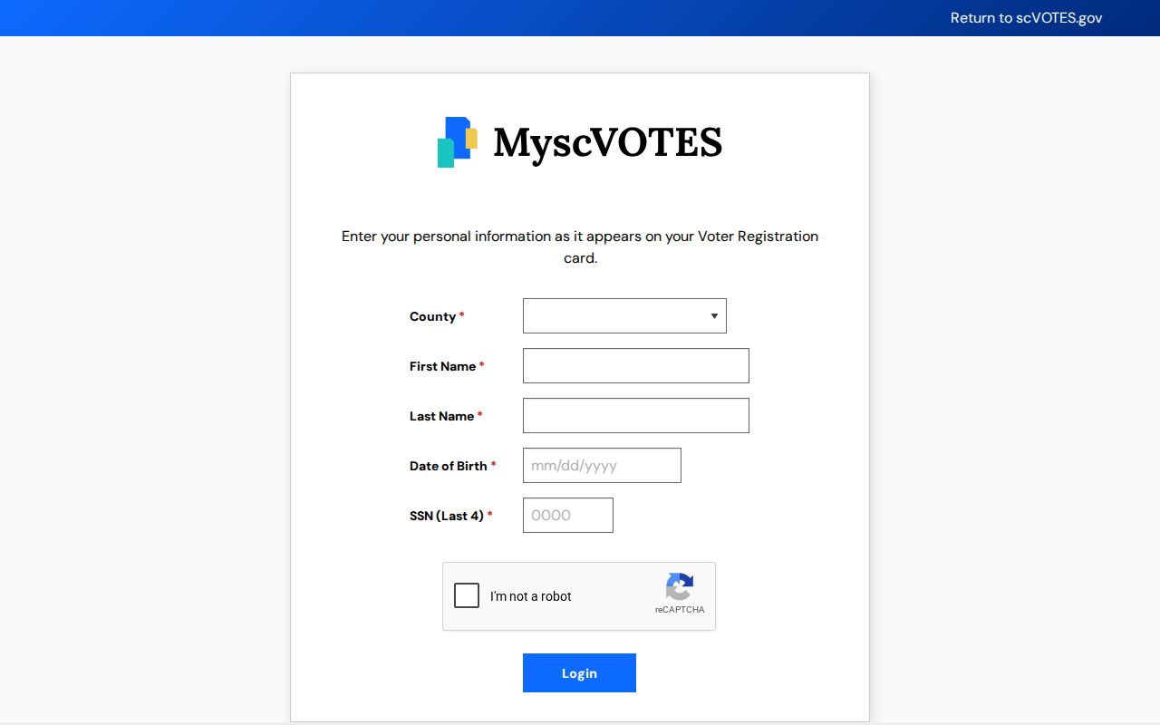
The login design is a practical reminder that voter data has a personal-access boundary. S.C. Code §7-5-170 makes registration applications permanent records open to public inspection, but the research did not identify a public online all-voters-by-street search. Request current inspection details, permitted fields, and protected-address handling from the Charleston County Board of Voter Registration & Elections.
Charleston County Permit Timelines
Public permits and code cases can add a date layer to a parcel, but they are not proof of occupancy. City of Charleston CSS and county online services may show an address or TMS, a case type, review or inspection dates, and a listed applicant or contact. The City system applies inside city limits. A Charleston mailing name alone does not settle municipal jurisdiction, especially across a county that includes islands, suburbs, and several municipalities.
Use the Charleston County municipal list to identify which city or town may hold a local permit or contact source. Then preserve the case number, agency, address, and date. A named representative is a documented role in that file, not a present resident of the parcel.
Note: Parcel records, permits, and court files should be read within the jurisdiction and date shown by their custodian.
Charleston County Neighborhood History
Charleston's community layer is archival and geographic, not a countywide directory of members. The City of Charleston's Area Character Appraisals identify material for Cannonborough/Elliottborough, Old Windermere, Byrnes Downs, Wagener Terrace, and North Central. The 2024 Wagener Terrace and 2025 North Central materials were made with preservation organizations. They help place a block in a physical and historical era. They do not identify current households or association membership.
Use an appraisal's map or history to orient an address, then return to an official parcel, deed, permit, or dated directory source for a specific record question.
| Community resource | Geography or role | Proper use |
|---|---|---|
| Area Character Appraisals | Named City of Charleston neighborhoods | Public reports and maps, not a resident directory |
| City staff directory | City departments and officials | Official public contacts, not neighborhood membership |
| CCPL South Carolina Room and Charleston Archive | Countywide local history | Maps, clippings, directories, and research assistance |
| Charleston Library Society and Lowcountry Digital Library | Charleston and Lowcountry collections | Digitized directories and manuscripts, subject to collection access |
Comparing Charleston County Neighbor Sources
Official records identify the scope and date of what they show. Commercial neighbor-search tools may combine public and purchased data, merge similar names, and retain stale addresses. They are not record custodians. Where a claim matters, go back to the Assessor, GIS viewer, Register of Deeds, court, library, or other original office and check the date and role shown there.
| Official parcel trail | Commercial neighbor tools |
|---|---|
| Names the custodian, record type, date, and parcel relationship | May combine records with different dates and purposes |
| Allows a reader to inspect the source record or office procedure | Can obscure how a name or address was matched |
| Separates assessed ownership from occupancy | May present an uncertain connection as a current profile |
For historic neighbors, CCPL city-directory street sections are useful only in years that include them. Street indexes generally begin in 1890, except for 1840 to 1841. A directory entry is evidence for its publication year, not a current block list.
Charleston County Neighbor Privacy
Private household information does not become public because a parcel is nearby. Utility and delivery information are not a public block register. Court files can be sealed or confidential, and home addresses no longer appear on the County Public Index for new or existing cases as of January 1, 2026. The South Carolina Address Confidentiality Program gives qualifying participants a substitute address for state and local government agencies and courts, so a missing or altered address may be intentional and lawful.
The Family Privacy Protection Act limits knowing use of personal information from public records for commercial solicitation. Ask an original custodian about an error or a lawful correction path instead of attempting to expose a protected address. Association, congregation, and block-watch membership lists should not be assumed public.